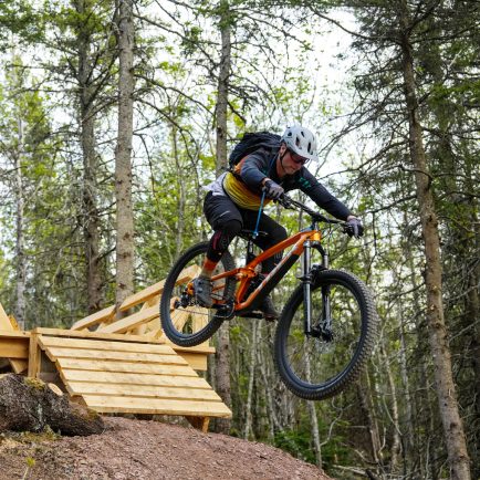
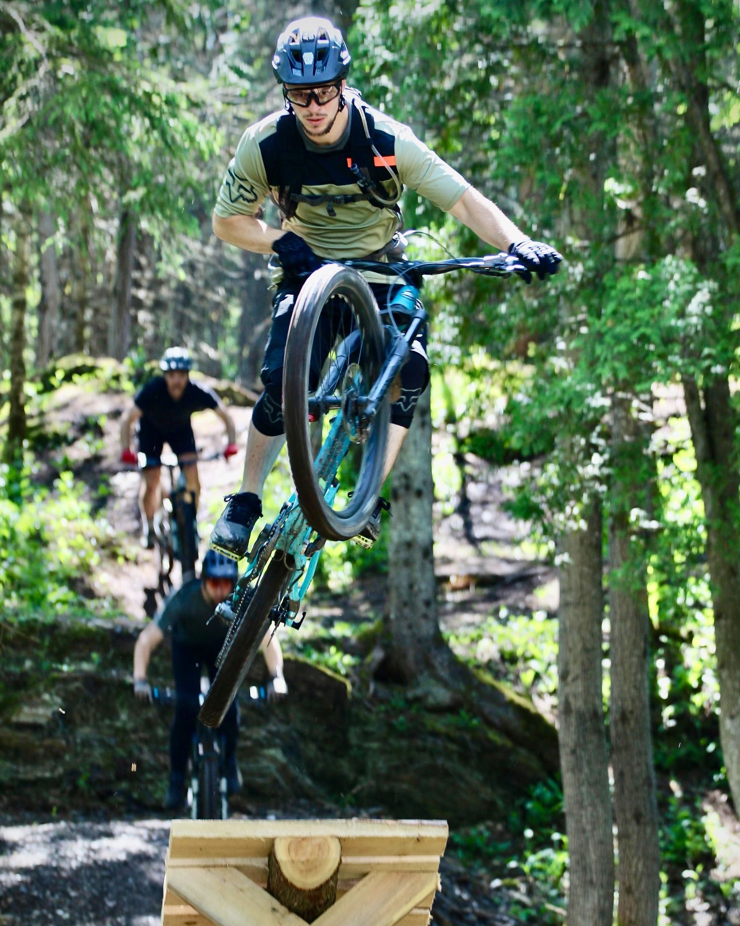
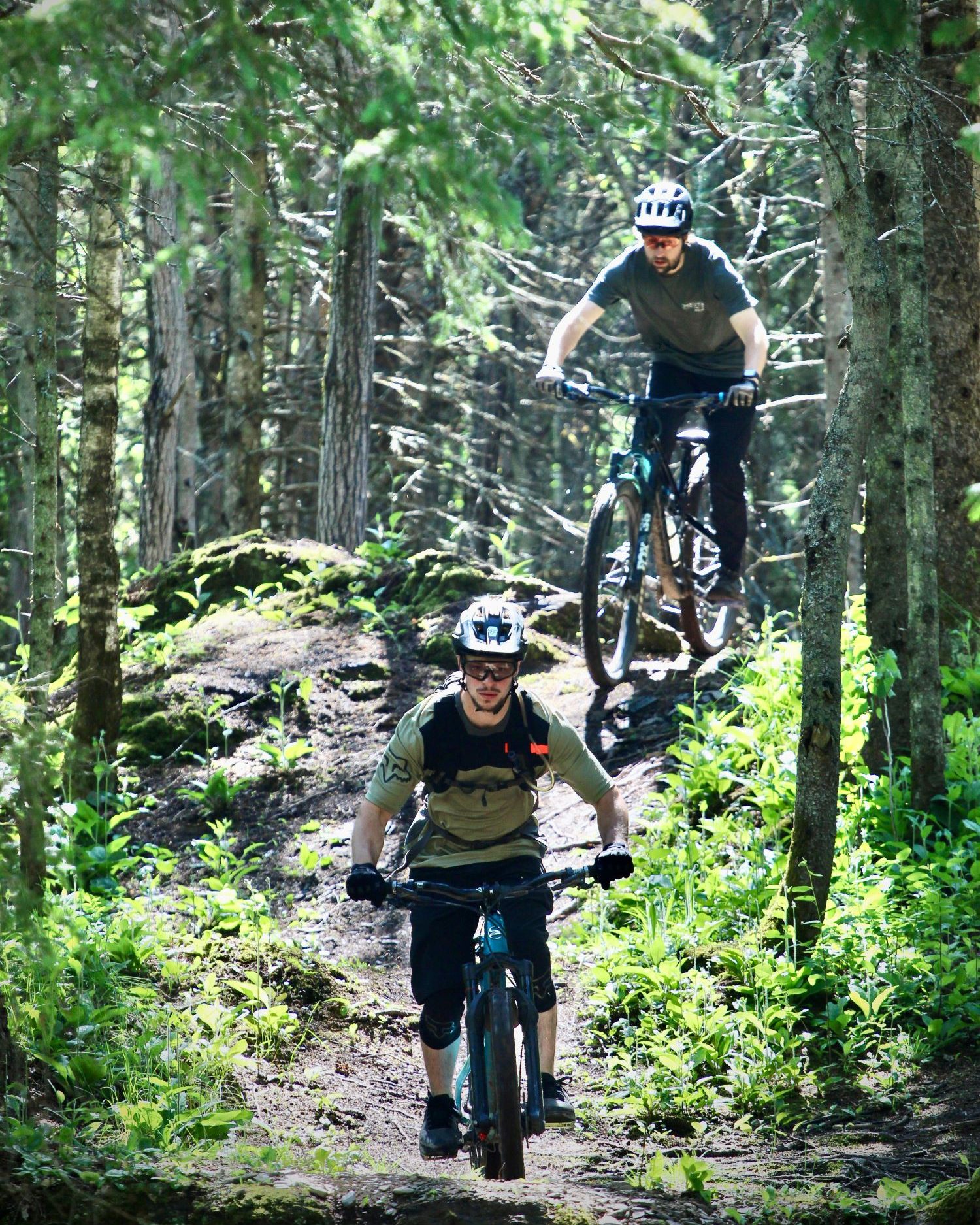
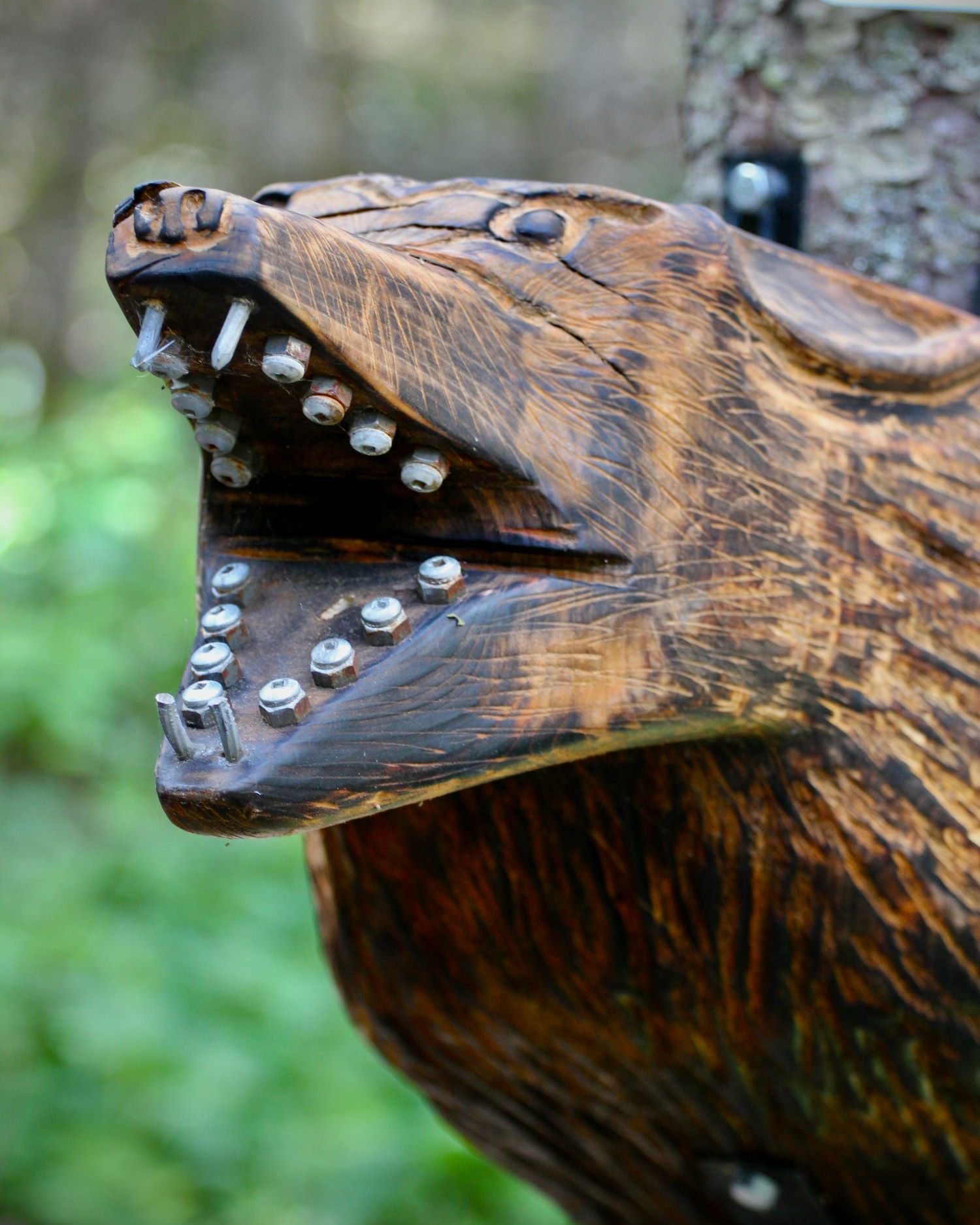
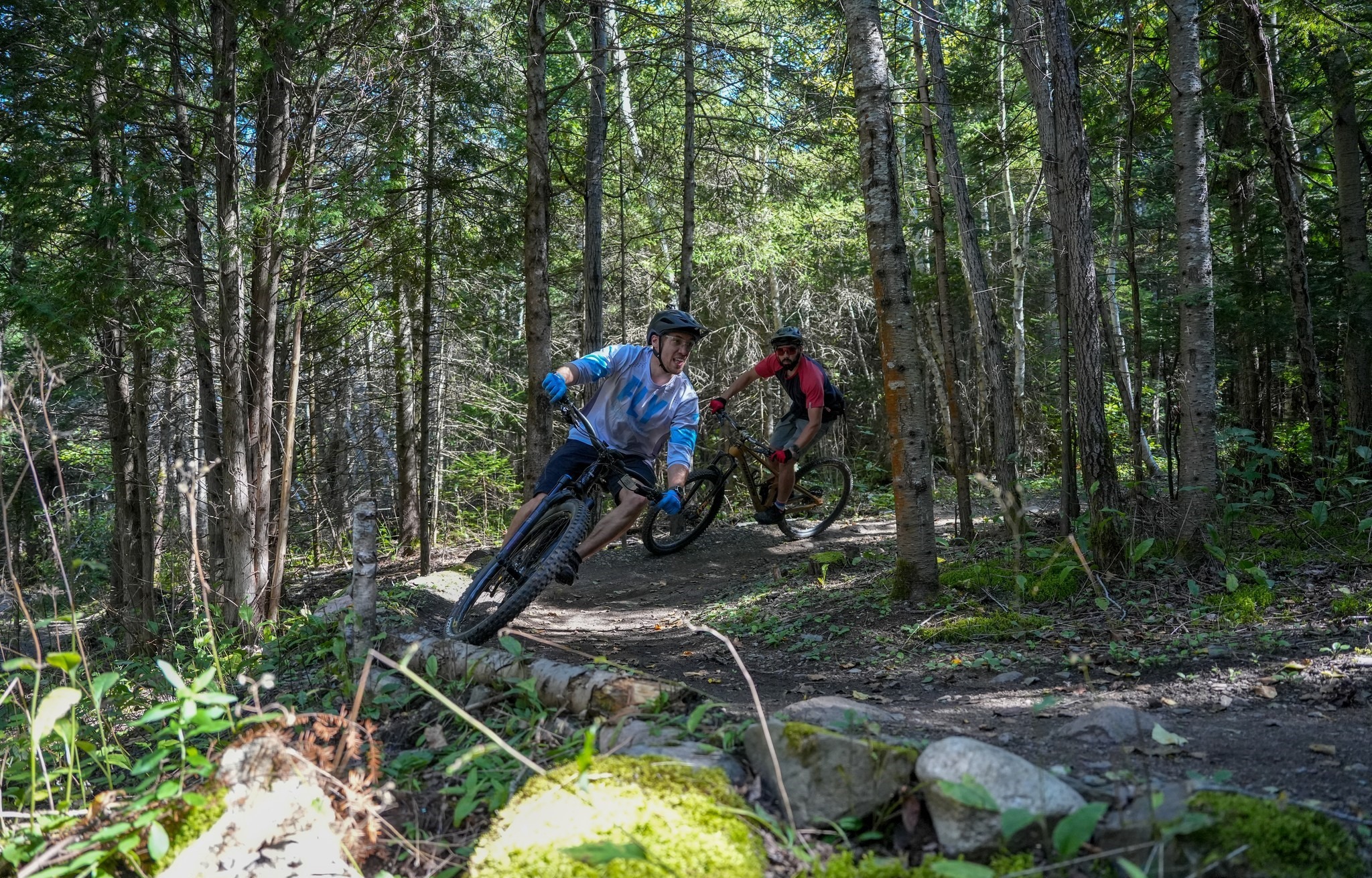
Biking Path and Tours

IMPORTANT


A section of the bike path remains closed at all times between Route Bossé, in Saint-Louis-du-Ha! Ha! and the south end of Principale Street in Saint-Honoré-de-Témiscouata (between kilometres 53 and 56 of Route 185).

Between June 23 and September 4, the Ministère will provide cyclists with a free shuttle service in this area to safely cross the construction site.

The shuttle will operate Thursday to Monday between 10 a.m. and 8 p.m.

This service will also be offered for the next summer periods until July 2026.

To learn more (french only)...

Take the time on bike

Let the good times roll — by bike!
How can you get the most out of your vacation? By discovering our region on two wheels!

The Bas-Saint-Laurent can also be explored by bike — tranquilly following the St. Lawrence, roaming the hills and valleys of the highlands, or wandering the marked bike trails and country roads. You'll make endless discoveries and remarkable memories along the way.

The varied terrain of the Bas-Saint-Laurent allows cyclists of all levels to choose a route tailored to their interests and abilities.

  • Looking for a physical challenge? The roads in the highlands of the Temiscouata region or the Neigette area, south of Rimouski, offer some good climbs and winding descents in the heart of nature. The numerous lakes and rivers provide breathtaking scenery!
  • If you prefer to enjoy your visit at a more sedate pace, the Route Verte bike trail runs along the St. Lawrence and is an easy and enjoyable ride. Bicycles share the road with cars on some sections, so cyclists should take extra care.
  • For families, the favourite route is unquestionably the Parc linéaire interprovincial Le Petit Témis. This dedicated hike and bike trail provides a safe and easy to ride, and has convenient facilities available along the way (toilets, picnic areas and primitive campsites). Built on an old railway, the trail leads from Rivière-du-Loup to Edmundston on 134 km of packed screened gravel. Several parking areas have been set up to facilitate access to the trail.

cycling friends

TOP 6 CIRCUITS

Le circuit des Églantiers
intermediate

From the heart of the lovely village of Kamouraska, this option takes you on Route 132, also called “Route des Navigateurs”, lined with beautiful ancestral houses. Beautiful landscapes will also punctuate your route bypassing several monadnocks, rocky hills typical of the Kamouraska lowlands creating its unique scenery. Other loops are possible between Kamouraska and Rivière-du-Loup (78 km / 48 mi.), or between Kamouraska and La Pocatière (62 km / 38 mi.).

Le Parc linéaire interprovincial Petit Témis 
easy (74 km)

This compacted gravel bike path follows an old railroad track starting in Rivière-du-Loup and crossing the Témiscouata region, all the way to New Brunswick (134 km / 84 mi.). In the town of Témiscouata-sur-le-Lac, you can hop on a ferry to Parc national du Lac-Témiscouata, on the other side of the lake (24 km / 15 mi. loop). From there, a bike path follows the lake shore southward to Saint-Juste-du-Lac, where another ferry takes you back to Notre-Dame-du-Lac.

Le circuit Terre et mer
intermediate (58 km)

This route unveils two distinct sides of the Bas-Saint-Laurent region: maritime and rural. Leaving the town of Trois-Pistoles westward on Route 132, it crosses a plateau before going down to sea level along L'Isle-Verte Cove. After a short ferry ride, you can set foot (and wheels) on Île Verte and ride its quiet roads from tip to tip. Back on the “continent”, a steady climb takes you to 2e rang (rural road), a slightly hilly road with very little traffic. Going back to Trois-Pistoles you will pass in front of the municipal campground.

Le Grand circuit maritime
experienced (61.5 km)

From Rimouski, follow the bike path along the St. Lawrence River eastward. The route rides alternately on paved bike paths and small roads and streets following the curves of the shore, going through Pointe-au-Père Maritime Historic Site. Take a break in the picturesque village of Sainte-Luce to have a snack before getting back on the saddle all the way to Sainte-Flavie, known as the gateway to the Gaspésie region. You still have some energy left? Ride the loop to Saint-Valérien and Saint-Fabien (69 km / 43 mi.). Beware: there are some serious climbs!

Le circuit de la route des Frontières
intermediate (118 km)

Let yourself be charmed by the natural, historic and cultural richness of this route! From the beach in Pohénégamook, take Chemin de la Tête-du-Lac to Route 289. From there, navigation couldn't be easier since you simply follow Route 289 to New Brunswick, starting along the west side of Lake Pohénégamook, then along the border with Maine to Saint-Marc-du-Lac-Long. The hilly road has some amazing viewpoints on the forested hills of the area. 

Le circuit cyclosportif
experienced (55 km)

This is a tough one! It includes several climbs that will challenge even the strongest cyclists. Because it follows small roads parallel to the Trans-Canada Highway (Highway 85), traffic is light and pavement has been redone recently for the most part of this route during the highway improvement project. Some 55 km (34 mi.) long, it boasts a vertical gain of 751 metres (2464 feet). And even if it's a perfect training ground, take the time to appreciate the several vistas on Lake Témiscouata!

By continuing to browse this site, you accept our privacy policy in relation to cookies to offer you content and services adapted to your needs.

Accept Know more