


My Favorites
Sentier national au Bas-Saint-Laurent
Trois-Pistoles à Dégelis, Trois-Pistoles, Québec G0L 4K0
About
“Trois-Pistoles/Dégelis” section
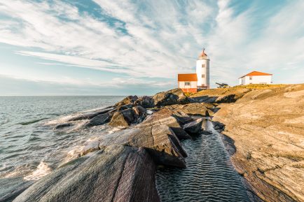
This portion extends over 144 kilometers (12 sections) from Trois-Pistoles to Dégelis. It crosses the Lac-Témiscouata national park and is marked by the omnipresence of expanses, planes and watercourses. Walkers will follow or cross the waterways on equipped footbridges. This route was once taken by Native American tribes moving between the St. Lawrence and the Bay of Fundy. Areas accessible for snowshoeing.
Seven rustic shelters on the route that can accommodate up to eight people all year round. Mandatory reservation. Other types of accommodation available along the route. Parking and reception and information signage provided at the start and finish of each section. Free access, except for the portion located in the national park where daily access fees are required. Pets on a leash accepted in the portion outside the Lac-Témiscouata national park.
Section “Le Chemin du Roy”
Long 31 kilometers, this section uses the Route verte which runs through the municipalities from Trois-Pistoles, Notre-Dame-des-Neiges and Saint-Simon. The starting point, to the west, is located near the Trois-Pistoles marina building and the arrival point is located at the intersection of Chemin Porc-Pic and Route 132 in Saint-Simon. This axis of the National Trail in Bas-Saint-Laurent offers many unique views of the river.
Section “Chute-Neigette/Mont-Comi”
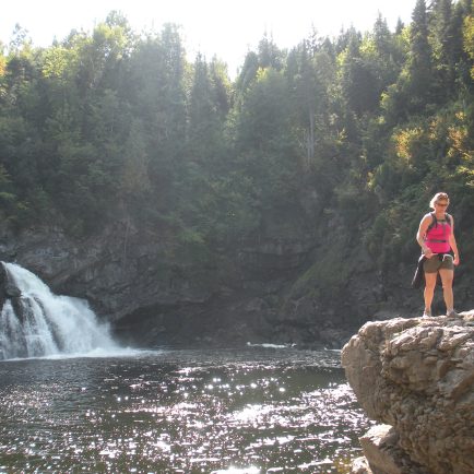
Section of nearly 15 kilometers , intermediate/advanced level, located on the ridge along the Neigette River valley. The trail offers views of farmland, mountains, and the St. Lawrence River. The trail begins in Saint-Anaclet at Neigette Falls, more than 100 feet high, and ends at Parc du Mont-Comi in Saint-Donat, where Mont Comi reaches an altitude of 575 meters. The main attractions are the Neigette River and the footbridge which overlooks the Neigette Falls, a covered bridge, the presence of still well preserved remains of a lime kiln, various viewpoints over the valley and a rugged terrain where Mont Comi predominates. .
At Neigette Falls, parking is located on Fourneau-à-chaux road about 1.5 kilometers south of Rang Neigette. From Saint-Anaclet, take Route Neigette (west of the church, rue Principale) heading south. Drive to the end of it and turn left onto Rang Neigette (east direction). Go about 2 kilometers and turn onto the Fourneau-à-chaux road on your right.
At the Parc du Mont-Comi, from Saint-Donat, take road 298, heading south. Go about 6 kilometers, turn right on Chemin du Plateau which leads to the ski resort. Follow this road to the ski chalet where parking is shared with that of the National Trail.
Access
Gratuit


