


My Favorites
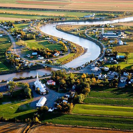
Municipalité de Rivière-Ouelle
133, route 132, Rivière-Ouelle, Québec G0L 2C0
About
Municipality advantageously located on the banks of the river and the Ouelle river. Discover the beauty of this charming village and its built heritage by exploring it in different ways. Paddle the meanders of the river and on the river, pedal the different routes of the cycle network, walk in the heart of the village or on the beaches, drive on the country roads.
All of this will take you will allow you to discover the parks, the church and its ex-voto, the eel fishing sites, to play ornithologist, to pick small fruits, to explore the land of your ancestors by going to meet of these with the Memory Passers circuits, to experience the history of yesterday to today that the Fil Rouge circuit offers, to discover the wayside crosses, to camp to the sound of the waves and above all to admire the sunsets sunshine on the river. Welcome to our home and happy holidays!


